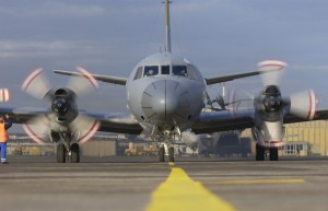
When the CP-140 Aurora long-range maritime patrol aircraft entered service in 1980, it was the most advanced anti-submarine warfare platform of its time. When the Royal Canadian Air Force completes its incremental modernization of the Aurora, it will regain its status as a leading-edge intelligence, surveillance and reconnaissance (ISR) platform.
It will also be a large generator of data.
One of the ongoing challenges for the RCAF as it reintroduces the upgraded CP-140 and explores its options for medium to high altitude unmanned systems and a next generation fighter, is how to deliver that critical data generated aboard these aircraft to decision-makers on the ground in near-real time while also allowing airborne pilots and mission system operators to interrogate ground-based databases.
Traditionally, an aircraft had to land before the information it gathered from its sensor suite could be downloaded to a network and accessed or disseminated.
A joint technology demonstration project between the RCAF and Defence Research and Development Canada (DRDC) will soon change that.
The Radar and Imaging for the Land/Littoral Environment, better known by its acronym, RIFL2E, will allow operators on the ground direct access to the data while the aircraft is still in the air.
Specifically, the project employs a new airborne satellite communications terminal to transmit and access near-real time ISR data from nearly any location worldwide without having to also deploy ground operators. The equipment consists of a transmitter and a storage device approximately the size of a satellite dish and a television receiver.
“The RIFL2E architecture eliminates the requirement for deployed ground support by using an on-board network enabled database,” explained Captain Gordon Keyser, the deputy project manager for RIFL2E. “The architecture enables storage of all ISR data collected by on-board sensors. Selected data can then be transmitted through a dedicated Beyond Line of Sight (BLOS) satellite communications (SATCOM) terminal to a land-based network in near-real time. This provides users at ground-based terminals with access to imagery within seconds of its collection by remote airborne sensors. Similarly, the users onboard the aircraft can search the ground-based imagery database network for previously recorded imagery.”
The project began in 2007 with an initial goal of demonstrating a better way to conduct sensing operations in remote environments, especially as the Canadian Armed Forces (CAF) intensified its mission in Afghanistan and turned greater attention to operations and exercises in the Arctic.
That effort paid off last June when a National Research Council of Canada (NRC) Convair 580 aircraft equipped with the RIFL2E transmitter and receiver completed its first successful test flight, demonstrating the use of advanced SATCOM and networking systems.
Two months later, RIFL2E’s capability was showcased in an operational demonstration during the CAF’s annual Operation Nanook – that year in the Beaufort Delta region of the Northwest Territories and in Hudson Strait and Hudson Bay – successfully transferring ISR data from Inuvik to various CAF sites and fusion centres across the country.
With the success of Op Nanook, the CAF are now evaluating where the RIFL2E technology can best be used in the development of future equipment and what new ISR technologies can be tested. Although it is an air force project, the technology was “developed with flexibility to ensure it can be used by nearly any user, whether aboard a Royal Canadian Navy ship or by a Canadian Army ground user,” Keyser said.
He noted that a new imaging system was recently integrated into the NRC aircraft, significantly increasing the capability of the platform. The system was then used during a demonstration flight this past October that featured the first airborne Canadian control of a remote-operated camera via SATCOM. The control was done through a baseline application on a DND network, demonstrating the benefits of standardization, and will pave the way for future UAV controls and remote control of sensors onboard manned aircraft, such as a camera-equipped transporter.

Among its many goals, RIFL2E was developed not only to demonstrate a capability but also to encourage the standardization of ISR-related equipment. Consequently, the project has maintained a strong connection with industry.
“All of the technology used in the project is commercial off-the-shelf, and follows NATO standardization agreements (STANAGs) where applicable,” Keyser said. “RIFL2E shares its results and lessons learned with the industry. This includes SATCOM, imaging, networking experience, and the use of STANAGs to achieve the goals of the project. This sharing of knowledge exists to enable and encourage the widespread adoption of standardization within the ISR community. This will allow for a fully integrated military, capable of sharing information when appropriate, without the hindrance of incompatibility.”
While the RCAF and DRDC have led the project, RIFL2E represents a multi-organization effort. According to Anthony Damini, a defence scientist with DRDC, the system design and integration were conducted by an integrated team consisting of DRDC, NRC, Communications Research Centre Canada and Assistant Deputy Minister (Materiel) staff. “Each group played a vital part in the development of RIFL2E, from system design to integration and employment,” he said.
Although the technology demonstration project is nearing completion, RIFL2E’s technology, equipment and expertise will be essential for further research and development. They will play a key role in the capability development of future ISR assets such as the Joint Unmanned Surveillance Target Acquisition System.