
When every second counts in the open ocean, coastguards worldwide demand maximal situational awareness for today’s search and rescue (SAR) operations. For this reason, CarteNav and MetOcean Telematics are pleased to announce integration of the Iridium Self Locating Datum Marker Buoy (iSLDMB) with both AIMS-ISR for real-time mission management and AIMS-C4 for SAR command and control in a Common Operating Picture.
Carl Daniels, COO of CarteNav said, “I am thrilled to announce the integration of MetOcean Telematics’ iSLDMB product with both AIMS-ISR and AIMS-C4 – together, they enable this crucial data to serve coastguard operators both in real-time and historically within a complete mission data lifecycle. The team is particularly pleased that together as geographic neighbours, we are bringing this new and dependable SAR solution to the global market, showcasing Atlantic Canada’s world-class development for ocean technologies.”
The MetOcean Telematics iSLDMB meets the stringent performance requirements of coastguards for Search and Rescue (SAR) operations in the open ocean by being innovative, rugged, and compact. When deployed, the buoy communicates subsurface ocean currents and temperature in real- time. This provides critical data to decision-makers tasked with rescuing a person, vessel, or aircraft lost at sea.
“We are delighted to witness the successful integration of MetOcean’s iSLDMB with CarteNav’s mission critical platforms; AIMS-ISR and AIMS-C4. This collaboration will provide SAR operators with the full gamut of real-time data access during active missions, when data is critical, and lives are on-the-line. It was a true pleasure working with the team at CarteNav and we look forward to future opportunities where we can collaborate,” says Tony Chedrawy, MetOcean CEO
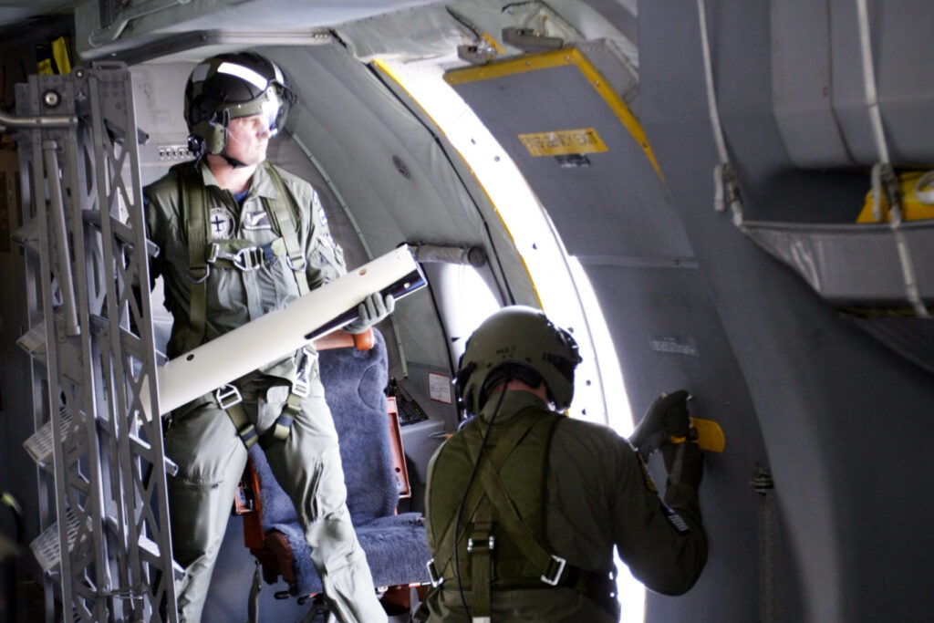
Deployed by the air crew, MetOcean drift marker buoys can now be tracked by the AIMS-ISR mission system. Drift marker buoys provide valuable data via the Iridium network to the onboard AIMS-ISR mission system. This provides essential insight into the ocean environment. Onboard operators receive the tracking information from the buoys and can then conduct the most effective search and rescue plan. Maximum operator situational awareness and search effectiveness is achieved as the buoy data is displayed alongside other sensor data such as radar, AIS, and ViDAR.
AIMS-C4 provides the real-time and historical data from all deployed ISLDMB data in a Common Operating Picture for search and rescue coordinators on the ground. The rescue coordination centre creates SAR models and plans for achieving mission success through the use of the real-time and historical data.